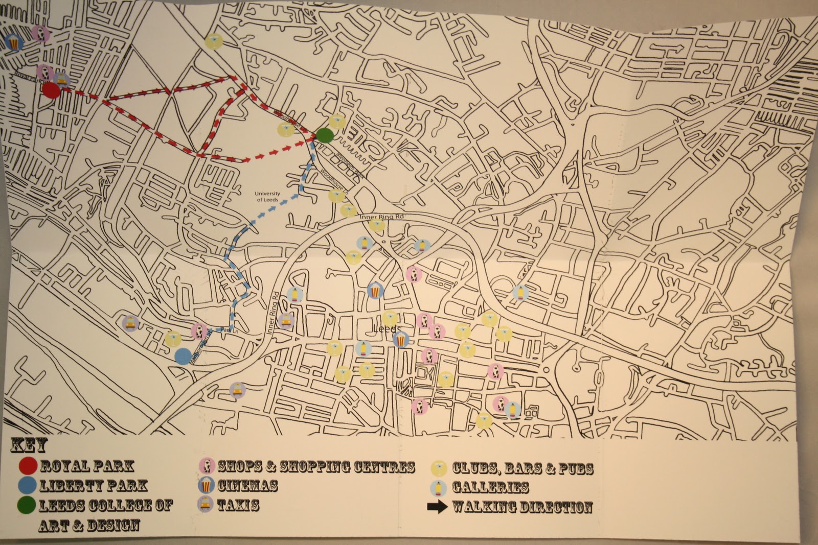
The final map shows an idea of the routes taken from two specific halls, liberty park and royal park, represented by different colours, on the completed map, all the routes would be highlighted, which are represented by the symbols seen before.
this post also shows the examples of the extra info used on the map. the specific colour styles used were used due to there ability to catch the eye and make that generally more interesting to look at.


No comments:
Post a Comment